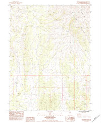
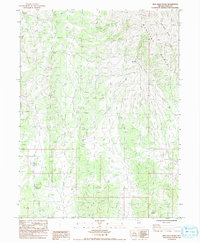
1984 Map of High Bald Peaks
USGS Topo · Published 1984About this map
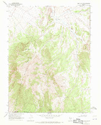
Medicine Range dominates the eastern half of this high-altitude landscape in northeastern Nevada. As a provisional survey conducted in the early 1980s, the map highlights the stark reality of the Great Basin wilderness, where human infrastructure is largely confined to primitive transportation routes and livestock management. The High Bald Peaks define the northern topography, while the lower elevations are marked by a network of 4wd tracks that follow natural contours and drainage patterns. A singular point of interest, the Mat Tank Corral, indicates the area's continued use for open-range ranching. Survey markers like Bm 63 Dor 2019.3 provide precise elevation data for this segment of Elko County, documenting a region where the land remains largely defined by its geological features rather than permanent settlement.
Find a feature on this map
10 named features on this map. Tap any name to fly to it.
Don’t see what you’re looking for? This feature index may not catch every label — zoom into the map to look around manually.
Map Details
Editions of this 1984 High Bald Peaks Map
2 editions found
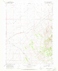
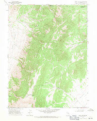
Other maps of this area

1955 · Elko
USGS Topo · 1:250,000

1958 · Elko
USGS Topo · 1:250,000

1962 · Elko
USGS Topo · 1:250,000

1965 · Elko
USGS Topo · 1:250,000
1968 · Franklin Lake SE
USGS Topo · 1:24,000
1968 · Ruby Lake SE
USGS Topo · 1:24,000
1968 · Ruby Lake NE
USGS Topo · 1:24,000

1984 · High Bald Peaks SE
USGS Topo · 1:24,000
1984 · Medicine Spring
USGS Topo · 1:24,000
1984 · High Bald Peaks NE
USGS Topo · 1:24,000