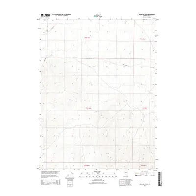
2014 Map of Medicine Spring
USGS Topo · Published 2014About this map
Ruby Valley and the high elevations of the Medicine Range dominate this interior portion of Elko County. The landscape is defined by its water sources, which are critical in this arid environment, including the eponymous Medicine Spring and Mud Spring. These features, along with the drainage of Cabin Run, shaped the local movement and land use throughout the 20th century. The road network is sparse, centered on routes like Medicine Spring Rd and Ruby Wash Rd, which follow the natural contours of the wash and valley. This survey reflects the enduring character of the Great Basin, where transportation and settlement patterns are dictated by the proximity to reliable springs and the passage between mountain ranges.
Find a feature on this map
13 named features on this map. Tap any name to fly to it.
Don’t see what you’re looking for? This feature index may not catch every label — zoom into the map to look around manually.
Map Details
Editions of this 2014 Medicine Spring Map
This is the sole edition of this map. No revisions or reprints were ever made.
Other maps of this area

1955 · Elko
USGS Topo · 1:250,000

1958 · Elko
USGS Topo · 1:250,000

1962 · Elko
USGS Topo · 1:250,000

1965 · Elko
USGS Topo · 1:250,000

1968 · Franklin Lake SE
USGS Topo · 1:24,000

1968 · Franklin Lake NE
USGS Topo · 1:24,000

1968 · Ruby Lake NE
USGS Topo · 1:24,000

1984 · West of Delcer Buttes
USGS Topo · 1:24,000
1984 · High Bald Peaks
USGS Topo · 1:24,000

1984 · Delcer Buttes
USGS Topo · 1:24,000