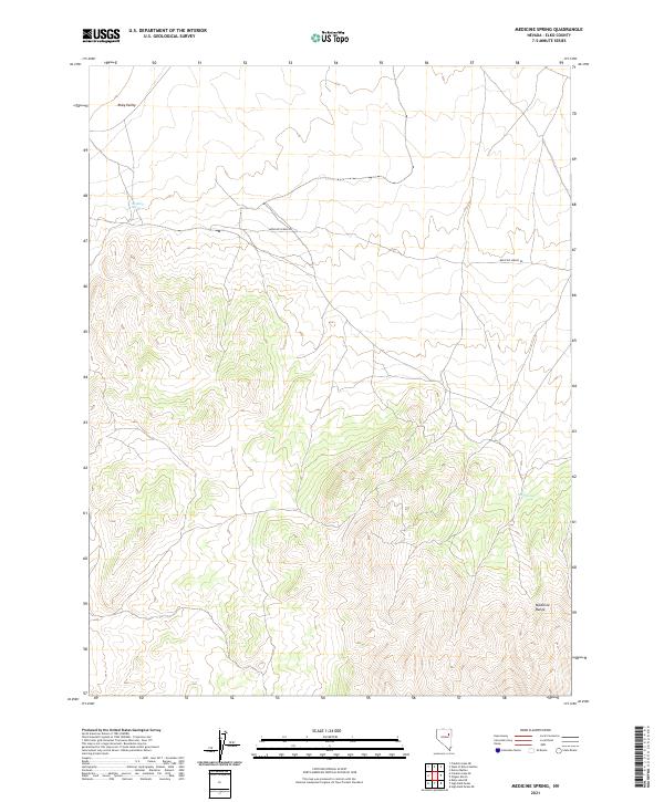
2021 Map of Medicine Spring
USGS Topo · Published 2021About this map
Ruby Valley and the northern reaches of the Medicine Range define this high-altitude landscape in northeastern Nevada. This 2021 survey details the topography of the Elko County backcountry, where the presence of Medicine Spring and Mud Spring provided vital water sources in a largely arid environment. The map highlights the sparse infrastructure of the region, anchored by the winding path of Medicine Spring Rd, which traverses the basin between the mountain slopes. The land is organized by the Public Land Survey System, showing township and range boundaries such as t29n r60e and t28n r61e. This cartographic record provides a clear view of the drainage patterns and elevation changes that shaped local movement and land use throughout the late twentieth and early twenty-first centuries.
Find a feature on this map
11 named features on this map. Tap any name to fly to it.
Don’t see what you’re looking for? This feature index may not catch every label — zoom into the map to look around manually.
Map Details
Editions of this 2021 Medicine Spring Map
This is the sole edition of this map. No revisions or reprints were ever made.
Other maps of this area

1955 · Elko
USGS Topo · 1:250,000

1958 · Elko
USGS Topo · 1:250,000

1962 · Elko
USGS Topo · 1:250,000

1965 · Elko
USGS Topo · 1:250,000

1968 · Franklin Lake SE
USGS Topo · 1:24,000

1968 · Franklin Lake NE
USGS Topo · 1:24,000

1968 · Ruby Lake NE
USGS Topo · 1:24,000

1984 · West of Delcer Buttes
USGS Topo · 1:24,000
1984 · High Bald Peaks
USGS Topo · 1:24,000

1984 · Delcer Buttes
USGS Topo · 1:24,000