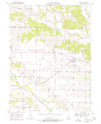
1950 Map of Medill
USGS Topo · Published 1977About this map
The Burlington Northern Railroad and the Atchison Topeka and Santa Fe Railroad intersect at the village of Medill, a critical rail junction in Clark County during the mid-century. This survey, updated with 1970s aerial revisions, documents a landscape shaped by both active transport and historical rail footprints, most notably the Old Atchison Topeka and Santa Fe Railroad Grade. Small rural communities like Luray and Ashton are shown with their corresponding local landmarks, including the Zimmerman Cem and Ashton Ch.
Find a feature on this map
33 named features on this map. Tap any name to fly to it.
Don’t see what you’re looking for? This feature index may not catch every label — zoom into the map to look around manually.
Map Details
Editions of this 1950 Medill Map
2 editions found
Other maps of this area

1903 · Kahoka
USGS Topo · 1:125,000

1949 · Kahoka
USGS Topo · 1:24,000

1949 · St. Patrick
USGS Topo · 1:24,000

1950 · Kahoka
USGS Topo · 1:24,000

1950 · Saint Patrick
USGS Topo · 1:24,000

1950 · Neeper
USGS Topo · 1:24,000

1950 · Medill
USGS Topo · 1:24,000

1950 · Colony
USGS Topo · 1:24,000

1951 · Colony
USGS Topo · 1:24,000

1951 · Neeper
USGS Topo · 1:24,000