
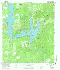
1964 Map of Medina Lake
USGS Topo · Published 1968About this map
Medina Lake dominates this mid-1960s landscape, illustrating the complex shoreline of the reservoir formed by the Medina Dam at the border of Medina and Bandera counties. Residential developments like Lake Hills and Lake Medina Highlands occupy the peninsula between Elm Cove and Spettel Cove, showcasing the mid-century transformation of the area into a recreational and residential hub. The terrain is marked by prominent landmarks such as Liebold Mountain and the steep Mormon Bluff overlooking the water. Downstream from the main dam, the Medina Irrigation Canal and Diversion Lake highlight the critical water infrastructure supporting the regional economy. Local social life is anchored by St Victors Chapel and St Francis Chapel, while industrial activity is noted by a Gravel Pit near the settlement of Mico.
Find a feature on this map
61 named features on this map. Tap any name to fly to it.
Don’t see what you’re looking for? This feature index may not catch every label — zoom into the map to look around manually.
Map Details
Editions of this 1964 Medina Lake Map
2 editions found
Other maps of this area

1954 · San Antonio
USGS Topo · 1:250,000

1956 · New Fountain
USGS Topo · 1:62,500

1956 · Bandera
USGS Topo · 1:62,500

1956 · Medina Lake
USGS Topo · 1:62,500

1957 · San Antonio
USGS Topo · 1:250,000

1958 · La Coste NE
USGS Topo · 1:24,000

1964 · Riomedina
USGS Topo · 1:24,000

1964 · Bandera
USGS Topo · 1:24,000

1964 · Timber Creek
USGS Topo · 1:24,000
1969 · Quihi
USGS Topo · 1:24,000