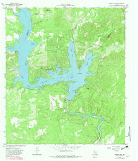
1964 Map of Medina Lake
USGS Topo · Published 1982About this map
Medina Lake dominates this rugged portion of the Hill Country along the boundary of Medina and Bandera Counties. Following the 1960s, the landscape reflects a transition toward recreational and residential development, most notably at Lake Hills and Lake Medina Highlands. The massive engineering of the Medina Dam is clearly visible, holding back the water at a normal pool elevation of 1064 feet and feeding the downstream Diversion Lake and the Medina Irrigation Canal.
Find a feature on this map
61 named features on this map. Tap any name to fly to it.
Don’t see what you’re looking for? This feature index may not catch every label — zoom into the map to look around manually.
Map Details
Editions of this 1964 Medina Lake Map
2 editions found
Other maps of this area

1954 · San Antonio
USGS Topo · 1:250,000

1956 · New Fountain
USGS Topo · 1:62,500

1956 · Bandera
USGS Topo · 1:62,500

1956 · Medina Lake
USGS Topo · 1:62,500

1957 · San Antonio
USGS Topo · 1:250,000

1958 · La Coste NE
USGS Topo · 1:24,000

1964 · Riomedina
USGS Topo · 1:24,000

1964 · Bandera
USGS Topo · 1:24,000

1964 · Timber Creek
USGS Topo · 1:24,000

1964 · Medina Lake
USGS Topo · 1:24,000