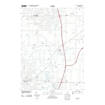
2010 Map of Medina
USGS Topo · Published 2010About this map
The growing suburban corridor of northern Medina County is anchored here by Brunswick and the northern reaches of Medina. The landscape is a transition between established residential development and the rural agricultural roots of the Western Reserve, evidenced by the high density of family and community burial grounds such as Brunswick-Center Cemetery and the Old Medina Cemetery. Water management is a defining characteristic of the terrain, with numerous private and municipal impoundments like Lake Medina, Lake Brunswick, and Carol-Jane Lake dotting the drainages of the North Branch West Branch Rocky River. Small crossroads settlements including Weymouth, Sherman Corners, and Windfall persist amidst the expanding infrastructure of Medina Municipal Airport and modern commerce centers, while several golf courses including Brunswick Hills Golf Course and Skyland Golf Course utilize the remaining open space.
Find a feature on this map
89 named features on this map. Tap any name to fly to it.
Don’t see what you’re looking for? This feature index may not catch every label — zoom into the map to look around manually.
Map Details
Editions of this 2010 Medina Map
This is the sole edition of this map. No revisions or reprints were ever made.
Other maps of this area

1902 · Berea
USGS Topo · 1:62,500

1903 · Cleveland
USGS Topo · 1:62,500

1903 · Akron
USGS Topo · 1:62,500

1904 · Berea
USGS Topo · 1:62,500

1904 · Medina
USGS Topo · 1:62,500

1905 · Akron
USGS Topo · 1:62,500

1906 · Medina
USGS Topo · 1:62,500

1950 · Cleveland
USGS Topo · 1:250,000

1953 · West View
USGS Topo · 1:24,000

1953 · Broadview Heights
USGS Topo · 1:24,000