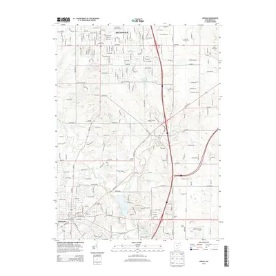
2013 Map of Medina
USGS Topo · Published 2013About this map
Medina and Brunswick anchor this modern survey, revealing the dense suburban development and transportation corridors connecting northern Ohio. The landscape is defined by the winding paths of the West Branch Rocky River and its various tributaries, which feed into significant water bodies like Lake Medina and Lake Brunswick. This network of waterways is juxtaposed against a rigid grid of residential streets and arterial roads such as Pearl Rd, reflecting the area's growth as a residential hub.
Find a feature on this map
212 named features on this map. Tap any name to fly to it.
Don’t see what you’re looking for? This feature index may not catch every label — zoom into the map to look around manually.
Map Details
Editions of this 2013 Medina Map
This is the sole edition of this map. No revisions or reprints were ever made.
Other maps of this area

1902 · Berea
USGS Topo · 1:62,500

1903 · Cleveland
USGS Topo · 1:62,500

1903 · Akron
USGS Topo · 1:62,500

1904 · Berea
USGS Topo · 1:62,500

1904 · Medina
USGS Topo · 1:62,500

1905 · Akron
USGS Topo · 1:62,500

1906 · Medina
USGS Topo · 1:62,500

1950 · Cleveland
USGS Topo · 1:250,000

1953 · West View
USGS Topo · 1:24,000

1953 · Broadview Heights
USGS Topo · 1:24,000