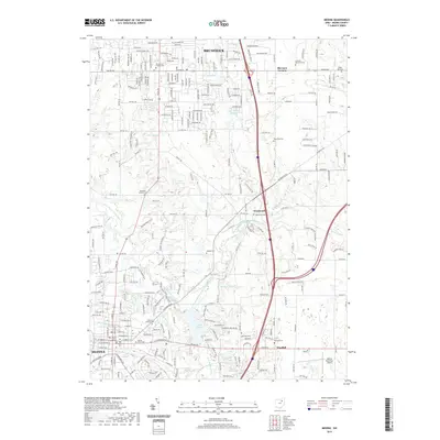
2019 Map of Medina
USGS Topo · Published 2019About this map
Brunswick and Medina anchor this modern landscape, connected by a network of suburban expansion and industrial corridors in Northeast Ohio. The topography is defined by the winding paths of the West Branch Rocky River and the North Branch West Branch Rocky River, which feed into numerous small reservoirs and community lakes like Lake Medina and Lake Sleepy Hollow. Historical continuity is visible in the preservation of numerous burial grounds scattered throughout the quadrangle, including the Old Medina Cem near the town center and the Bagdad Cem further north. While the Medina County Courthouse marks the civic heart of the area, the map also captures the sprawling logistics and residential developments reaching toward Sherman Corners and Weymouth, reflecting the ongoing integration of these former rural crossroads into the regional metropolitan fabric.
Find a feature on this map
42 named features on this map. Tap any name to fly to it.
Don’t see what you’re looking for? This feature index may not catch every label — zoom into the map to look around manually.
Map Details
Editions of this 2019 Medina Map
This is the sole edition of this map. No revisions or reprints were ever made.
Other maps of this area

1902 · Berea
USGS Topo · 1:62,500

1903 · Cleveland
USGS Topo · 1:62,500

1903 · Akron
USGS Topo · 1:62,500

1904 · Berea
USGS Topo · 1:62,500

1904 · Medina
USGS Topo · 1:62,500

1905 · Akron
USGS Topo · 1:62,500

1906 · Medina
USGS Topo · 1:62,500

1950 · Cleveland
USGS Topo · 1:250,000

1953 · West View
USGS Topo · 1:24,000

1953 · Broadview Heights
USGS Topo · 1:24,000