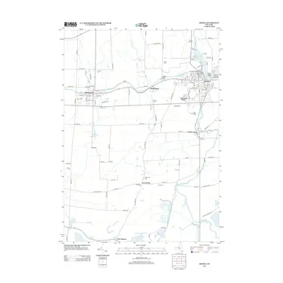
2013 Map of Medina
USGS Topo · Published 2013About this map
The Erie Canal flows through the northern half of this landscape, anchoring the historical development of Medina and Middleport. This industrial corridor is defined by infrastructure like the Avenue Bridge and Marshall Road Bridge, connecting the towns to the surrounding agricultural countryside. Beyond the canal, the map reveals a high density of rural burial grounds, including the Boxwood Cem and the Ketchum Cem, which serve as vital markers for local genealogical research. In the village of Medina, the street grid is well-defined around Glenwood Lake, while further south, the terrain transitions into a patchwork of named farms such as George Farms and Flyway Farm. Several watercourses, including Jeddo Cr and Oak Orchard Cr, drain the region, supporting local reservoirs and historical mill sites.
Find a feature on this map
123 named features on this map. Tap any name to fly to it.
Don’t see what you’re looking for? This feature index may not catch every label — zoom into the map to look around manually.
Map Details
Editions of this 2013 Medina Map
This is the sole edition of this map. No revisions or reprints were ever made.
Other maps of this area

1897 · Olcott
USGS Topo · 1:62,500

1897 · Medina
USGS Topo · 1:62,500

1897 · Lockport
USGS Topo · 1:62,500

1897 · Ridgeway
USGS Topo · 1:62,500

1899 · Niagara
USGS Topo · 1:125,000

1902 · Lockport
USGS Topo · 1:62,500

1905 · Lockport
USGS Topo · 1:62,500

1944 · Ashwood
USGS Topo · 1:31,680

1948 · Lockport
USGS Topo · 1:62,500

1948 · Olcott
USGS Topo · 1:62,500