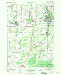
1949 Map of Medina
USGS Topo · Published 1970About this map
The Erie Canal cuts across this landscape, serving as a historic corridor that links the settlements of Middleport and Medina. This 1949 topographic survey illustrates the industrial and agricultural synergy of the era, where the New York Central railroad parallels the waterway to support local commerce in places like Shelby Basin. The presence of the Site of Neuter Fort south of the canal offers a rare archaeological reference to earlier inhabitants within the town of Shelby.
Find a feature on this map
57 named features on this map. Tap any name to fly to it.
Don’t see what you’re looking for? This feature index may not catch every label — zoom into the map to look around manually.
Map Details
Editions of this 1949 Medina Map
This is the sole edition of this map. No revisions or reprints were ever made.
Other maps of this area

1897 · Olcott
USGS Topo · 1:62,500

1897 · Medina
USGS Topo · 1:62,500

1897 · Lockport
USGS Topo · 1:62,500

1897 · Ridgeway
USGS Topo · 1:62,500

1899 · Niagara
USGS Topo · 1:125,000

1902 · Lockport
USGS Topo · 1:62,500

1905 · Lockport
USGS Topo · 1:62,500

1944 · Ashwood
USGS Topo · 1:31,680

1948 · Lockport
USGS Topo · 1:62,500

1948 · Olcott
USGS Topo · 1:62,500