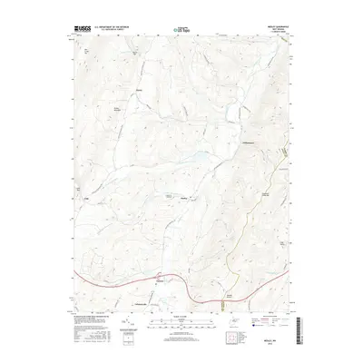
2016 Map of Medley
USGS Topo · Published 2016About this map
Patterson Creek and its various branches, including the N Fork Patterson Cr and Middle Fork Patterson Cr, dictate the layout of these West Virginia highlands. Small communities like Medley, Forman, and Lahmansville are positioned along the valley floors between the steep ridges of Knobly Mountain and Patterson Creek Mtn. The map highlights a rural infrastructure defined by historic mountain gaps, such as Harris Gap and Falls Gap, which have long served as vital passage points for local travel.
Find a feature on this map
46 named features on this map. Tap any name to fly to it.
Don’t see what you’re looking for? This feature index may not catch every label — zoom into the map to look around manually.
Map Details
Editions of this 2016 Medley Map
This is the sole edition of this map. No revisions or reprints were ever made.
Other maps of this area

1891 · Romney
USGS Topo · 1:125,000

1895 · Piedmont
USGS Topo · 1:125,000

1919 · Elk Garden
USGS Topo · 1:48,000

1920 · Elk Garden
USGS Topo · 1:48,000

1920 · Moorefield
USGS Topo · 1:62,500

1920 · Keyser
USGS Topo · 1:62,500

1921 · Keyser
USGS Topo · 1:48,000

1921 · Greenland Gap
USGS Topo · 1:62,500

1921 · Moorefield
USGS Topo · 1:48,000

1922 · Elk Garden
USGS Topo · 1:62,500