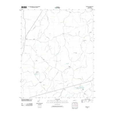
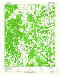
2010 Map of Medon
USGS Topo · Published 2010About this map
Medon serves as the primary settlement in this southwestern Tennessee landscape, where numerous family cemeteries reveal a deep-rooted genealogical history. The terrain is defined by a dense network of winding creeks and small-scale water management projects, including Ben Henry Lake and Lake Placid. The drainage pattern is complex, with Clover Creek and Bear Creek meandering through the rural landscape, punctuated by several structures such as the Deanburg Hills Dam and Wilderwood Dam.
Find a feature on this map
68 named features on this map. Tap any name to fly to it.
Don’t see what you’re looking for? This feature index may not catch every label — zoom into the map to look around manually.
Map Details
Editions of this 2010 Medon Map
This is the sole edition of this map. No revisions or reprints were ever made.
Other maps of this area

1950 · Jackson South
USGS Topo · 1:24,000

1953 · Beech Bluff
USGS Topo · 1:24,000

1956 · Blytheville
USGS Topo · 1:250,000

1959 · Blytheville
USGS Topo · 1:250,000

1959 · Westover
USGS Topo · 1:24,000

1961 · Medon
USGS Topo · 1:24,000
1961 · Silerton
USGS Topo · 1:24,000
1961 · Bolivar East
USGS Topo · 1:24,000
1961 · Henderson
USGS Topo · 1:24,000
1961 · Masseyville
USGS Topo · 1:24,000