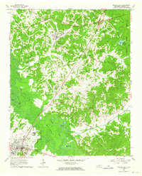
1961 Map of Bolivar East
USGS Topo · Published 1964About this map
The Hatchie River meanders through the western half of this Hardeman County region, creating a complex wetland environment marked by numerous oxbows and named pools such as Horseshoe Pond, Otter Pond, and The Grinnel Pond. The Illinois Central railroad cuts diagonally across the landscape, serving the established settlements of Toone, Shandy, and the northern edge of Bolivar. This transportation corridor was central to the local economy, connecting the agricultural uplands to regional markets.
Find a feature on this map
46 named features on this map. Tap any name to fly to it.
Don’t see what you’re looking for? This feature index may not catch every label — zoom into the map to look around manually.
Map Details
Editions of this 1961 Bolivar East Map
4 editions found
Other maps of this area

1950 · Hebron
USGS Topo · 1:24,000

1950 · Hornsby
USGS Topo · 1:24,000

1950 · Middleburg
USGS Topo · 1:24,000

1951 · Middleburg
USGS Topo · 1:24,000

1951 · Hebron
USGS Topo · 1:24,000

1951 · Hornsby
USGS Topo · 1:24,000

1956 · Blytheville
USGS Topo · 1:250,000

1959 · Blytheville
USGS Topo · 1:250,000

1961 · Bolivar West
USGS Topo · 1:24,000

1961 · Medon
USGS Topo · 1:24,000