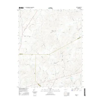
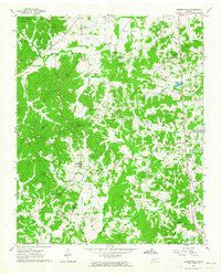
2016 Map of Medon
USGS Topo · Published 2016About this map
The settlement of Medon and its surrounding countryside are defined by a complex intersection of county lines where Madison, Hardeman, and Chester counties meet. This area of West Tennessee is marked by numerous small cemeteries and family-named landmarks, reflecting a deep-seated genealogical history. Numerous cemeteries such as Big Springs Cem, McDaniel Cem, and Pleasant Springs Cem are scattered across the landscape, often situated near water features like Clover Cr and Sandy Cr. The geography is further punctuated by private and local reservoirs, including Wilderwood Lake and the aptly named Lake Placid. Local road networks like Medon Malesus Rd and Parkburg Rd connect the primary communities of Parkburg and Deanburg, following the natural drainage patterns of the Bear Cr and Piney Cr watersheds.
Find a feature on this map
83 named features on this map. Tap any name to fly to it.
Don’t see what you’re looking for? This feature index may not catch every label — zoom into the map to look around manually.
Map Details
Editions of this 2016 Medon Map
This is the sole edition of this map. No revisions or reprints were ever made.
Other maps of this area

1950 · Jackson South
USGS Topo · 1:24,000

1953 · Beech Bluff
USGS Topo · 1:24,000

1956 · Blytheville
USGS Topo · 1:250,000

1959 · Blytheville
USGS Topo · 1:250,000

1959 · Westover
USGS Topo · 1:24,000

1961 · Medon
USGS Topo · 1:24,000
1961 · Silerton
USGS Topo · 1:24,000
1961 · Bolivar East
USGS Topo · 1:24,000
1961 · Henderson
USGS Topo · 1:24,000
1961 · Masseyville
USGS Topo · 1:24,000