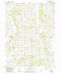
1983 Map of Medora
USGS Topo · Published 1983About this map
Liberty Center and the small hamlet of Medora anchor this rural landscape in Warren County during the early 1980s. The area is defined by its deep agricultural roots and a network of township boundaries including White Oak, Otter, Squaw, and Liberty. Local history is preserved through numerous family and community burial grounds, such as Indian Valley Cem, Schaver Cem, and Smith Cem, which are scattered among the drainage basins of Squaw Creek and Otter Creek.
Find a feature on this map
35 named features on this map. Tap any name to fly to it.
Don’t see what you’re looking for? This feature index may not catch every label — zoom into the map to look around manually.
Map Details
Editions of this 1983 Medora Map
2 editions found
Other maps of this area

1910 · Milo
USGS Topo · 1:62,500

1918 · Chariton
USGS Topo · 1:62,500

1931 · Indianola
USGS Topo · 1:62,500

1950 · New Virginia
USGS Topo · 1:62,500

1952 · New Virginia
USGS Topo · 1:62,500

1954 · Des Moines
USGS Topo · 1:250,000

1956 · Des Moines
USGS Topo · 1:250,000

1957 · Des Moines
USGS Topo · 1:250,000

1965 · Milo
USGS Topo · 1:24,000

1969 · Des Moines
USGS Topo · 1:250,000