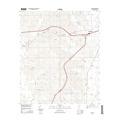
2015 Map of Meehan
USGS Topo · Published 2015About this map
Meridian dominates the eastern edge of this Lauderdale County landscape, where the urban outskirts meet the varied terrain of east Mississippi. The geography is defined by a series of creeks including Okatibbee Creek and Tallabatta Creek, while the Chunky River winds through the southwestern corner. This area serves as a significant transportation corridor, marked by the confluence of major highways and local thoroughfares like Old Highway 80 W. Small settlements such as Meehan, Lost Gap, and Sterling are scattered across the quadrangle, often anchored by local landmarks like Key Field or natural points of interest such as Tunnel Hill. For those tracing local heritage, the map identifies several historic burial grounds, including Tunnel Hill Cem, Burwell Cem, and Goodwater Cem, which provide tangible links to the families who established these rural communities.
Find a feature on this map
72 named features on this map. Tap any name to fly to it.
Don’t see what you’re looking for? This feature index may not catch every label — zoom into the map to look around manually.
Map Details
Editions of this 2015 Meehan Map
This is the sole edition of this map. No revisions or reprints were ever made.
Other maps of this area

1921 · Meridian
USGS Topo · 1:48,000

1923 · Meridian
USGS Topo · 1:62,500

1953 · Meridian
USGS Topo · 1:250,000

1957 · Meridian
USGS Topo · 1:250,000

1957 · Chunky
USGS Topo · 1:62,500

1957 · Quitman
USGS Topo · 1:62,500

1957 · Enterprise
USGS Topo · 1:62,500

1965 · Meridian
USGS Topo · 1:250,000

1971 · Meridian South
USGS Topo · 1:24,000

1971 · Meridian North
USGS Topo · 1:24,000