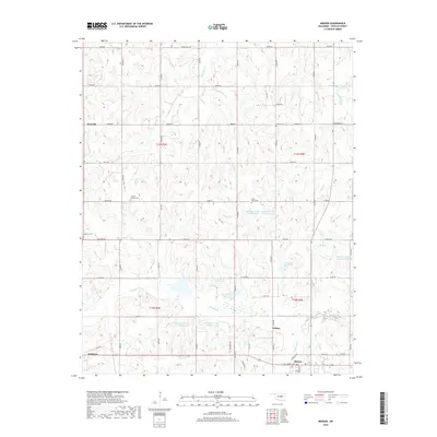
2018 Map of Meeker
USGS Topo · Published 2018About this map
Meeker and its surrounding Lincoln County landscape are defined by a complex network of water management and rural settlements. The drainage system of Quapaw Cr and Wildhorse Cr is heavily modified by numerous reservoirs, including Quapaw Cr Site 16 Reservoir and Quapaw Cr Site 17 Reservoir, illustrating the area's twentieth-century hydrological engineering efforts. These reservoirs are interspersed among smaller communities such as Jacktown, Clifton, and Rossville. Local history and genealogy are preserved in several scattered burial grounds, including Forest Cem, Horton Chapel Cem, and Saint Paul Cem, which anchor the surrounding farmsteads and section-line roads. The southern portion of the map is dominated by the town center of Meeker, where Carl Hubbel Blvd and Veterans Dr converge, providing a clear view of the town's modern layout and its relationship to S Quapaw Cr.
Find a feature on this map
49 named features on this map. Tap any name to fly to it.
Don’t see what you’re looking for? This feature index may not catch every label — zoom into the map to look around manually.
Map Details
Editions of this 2018 Meeker Map
This is the sole edition of this map. No revisions or reprints were ever made.
Other maps of this area

1896 · Seminole and Prague
USGS Topo · 1:125,000

1898 · Purcell
USGS Topo · 1:125,000

1905 · Chandler
USGS Topo · 1:62,500

1907 · Chandler
USGS Topo · 1:62,500

1909 · Shawnee
USGS Topo · 1:62,500

1909 · Luther
USGS Topo · 1:62,500

1930 · McLoud
USGS Topo · 1:62,500

1954 · Oklahoma City
USGS Topo · 1:250,000

1957 · Oklahoma City
USGS Topo · 1:250,000

1963 · Oklahoma City
USGS Topo · 1:250,000