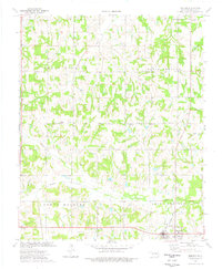
1974 Map of Meeker
USGS Topo · Published 1977About this map
The town of Meeker sits at a transport crossroads in Lincoln County during the mid-1970s, defined by the meeting of major roadways and the Atchison Topeka and Santa Fe railroad. This landscape is a patchwork of rural homesteads and agricultural allotments, with the surveying boundaries of North Wichita, North Choctaw, South Wichita, and South Choctaw reflecting the area's deep tribal history.
Find a feature on this map
27 named features on this map. Tap any name to fly to it.
Don’t see what you’re looking for? This feature index may not catch every label — zoom into the map to look around manually.
Map Details
Editions of this 1974 Meeker Map
This is the sole edition of this map. No revisions or reprints were ever made.
Other maps of this area

1896 · Seminole and Prague
USGS Topo · 1:125,000

1898 · Purcell
USGS Topo · 1:125,000

1905 · Chandler
USGS Topo · 1:62,500

1907 · Chandler
USGS Topo · 1:62,500

1909 · Shawnee
USGS Topo · 1:62,500

1909 · Luther
USGS Topo · 1:62,500

1930 · McLoud
USGS Topo · 1:62,500

1954 · Oklahoma City
USGS Topo · 1:250,000

1957 · Oklahoma City
USGS Topo · 1:250,000

1963 · Oklahoma City
USGS Topo · 1:250,000