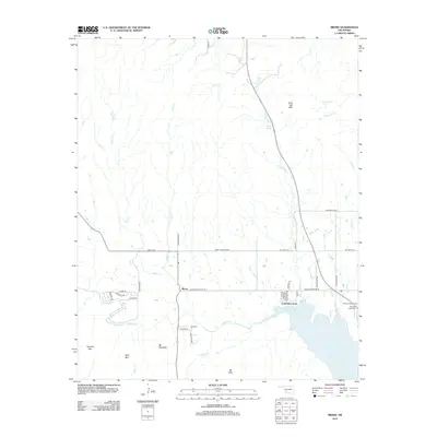
2012 Map of Meers
USGS Topo · Published 2012About this map
Lake Lawtonka anchors the southeastern corner of this landscape, its waters fed by the winding course of Medicine Cr and Canyon Cr. The settlement of Meers sits at the junction of Cache Meers Rd and Meers-Porter Hill Rd, serving as a central point for the surrounding rural roads. The topography is defined by prominent peaks including Mt Sheridan, Mt Wall, and Poko Mtn, which rise above the creek valleys of Tahoe Cr and Jimmy Cr. For those researching local heritage, the map identifies three significant burial grounds: Meers Cem, Mtn Scott Tribal Cem, and Mt Scott Tribal Cem. The transition from the more developed neighborhood of Lawtonka Acres near the lake to the high peaks of Tarbone Mtn illustrates the varied character of this Comanche County region.
Find a feature on this map
45 named features on this map. Tap any name to fly to it.
Don’t see what you’re looking for? This feature index may not catch every label — zoom into the map to look around manually.
Map Details
Editions of this 2012 Meers Map
This is the sole edition of this map. No revisions or reprints were ever made.
Other maps of this area

1937 · Cache
USGS Topo · 1:48,000

1937 · Quanah Mountain
USGS Topo · 1:24,000

1942 · Cache
USGS Topo · 1:62,500

1946 · Lawton
USGS Topo · 1:62,500

1949 · Mount Scott
USGS Topo · 1:24,000

1949 · Quanah Mountain
USGS Topo · 1:24,000

1949 · Fort Sill
USGS Topo · 1:24,000

1950 · Saddle Mountain
USGS Topo · 1:62,500

1955 · Lawton
USGS Topo · 1:250,000

1956 · Saddle Mountain
USGS Topo · 1:24,000