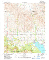
1991 Map of Meers
USGS Topo · Published 1992About this map
Meers serves as a focal point for this survey of the eastern edge of the Wichita Mountains, where the elevation begins to drop toward the plains. The landscape is defined by granite peaks like Mount Sheridan and Poko Mountain, with Medicine Creek flowing southeastward toward Lake Lawtonka. This corner of the Wichita Mountains National Wildlife Refuge includes notable cultural sites such as the Mount Scott Kiowa Mission and the Mountain Scott Tribal Center, reflecting the deep tribal heritage of the region. Local genealogy is supported by the presence of Meers Cem and small settlements like Lawtonka Acres. The terrain is crisscrossed by seasonal streams, including Jimmy Creek and Tahoe Creek, while the northeast features the Kimbell Ranch and Clowers.
Find a feature on this map
38 named features on this map. Tap any name to fly to it.
Don’t see what you’re looking for? This feature index may not catch every label — zoom into the map to look around manually.
Map Details
Editions of this 1991 Meers Map
2 editions found
Other maps of this area

1937 · Cache
USGS Topo · 1:48,000

1937 · Quanah Mountain
USGS Topo · 1:24,000

1942 · Cache
USGS Topo · 1:62,500

1946 · Lawton
USGS Topo · 1:62,500

1949 · Mount Scott
USGS Topo · 1:24,000

1949 · Quanah Mountain
USGS Topo · 1:24,000

1949 · Fort Sill
USGS Topo · 1:24,000

1950 · Saddle Mountain
USGS Topo · 1:62,500

1955 · Lawton
USGS Topo · 1:250,000

1956 · Saddle Mountain
USGS Topo · 1:24,000