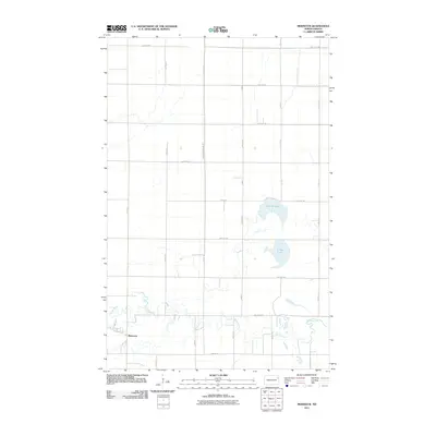
2011 Map of Mekinock
USGS Topo · Published 2011About this map
Mekinock sits at the southwestern edge of this landscape, where the meandering Turtle River cuts a winding path through the prairie. This 2011 survey illustrates a transition from the structured grid of the Red River Valley into a terrain dotted with significant local water bodies, most notably Stewart Lake and Lunby Lake. The area's agricultural character is underscored by the presence of County Ditch Number 12, an essential element of the region's historical water management system designed to make the flat, fertile land productive. A network of township roads, including 31st Ave NE and 20th St NE, connects the scattered farmsteads and rural properties, showing the enduring spatial organization of Grand Forks County well into the 21st century.
Find a feature on this map
26 named features on this map. Tap any name to fly to it.
Don’t see what you’re looking for? This feature index may not catch every label — zoom into the map to look around manually.
Map Details
Editions of this 2011 Mekinock Map
This is the sole edition of this map. No revisions or reprints were ever made.
Other maps of this area

1926 · Ardoch
USGS Topo · 1:62,500

1934 · Emerado
USGS Topo · 1:48,000

1934 · Grand Forks
USGS Topo · 1:62,500

1936 · Emerado
USGS Topo · 1:62,500

1938 · Grand Forks
USGS Topo · 1:62,500

1952 · Grand Forks
USGS Topo · 1:250,000

1952 · Thief River Falls
USGS Topo · 1:250,000

1956 · Thief River Falls
USGS Topo · 1:250,000

1956 · Grand Forks
USGS Topo · 1:250,000

1957 · Thief River Falls
USGS Topo · 1:250,000