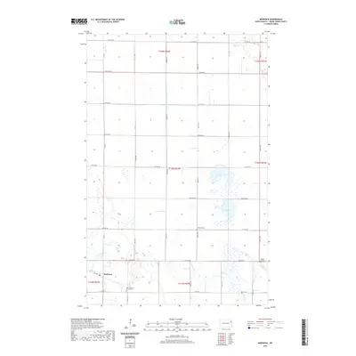
2020 Map of Mekinock
USGS Topo · Published 2020About this map
Mekinock serves as a central hub in this agricultural landscape of Grand Forks County, where the sprawling section lines of the Public Land Survey System define the movement of water and travelers. The winding course of the Turtle River provides a natural break in the geometric grid of roads like Co Rd 3 and 31st Ave NE. This 2020 map documents a region deeply rooted in its local heritage, evidenced by the clustered presence of rural burial grounds and places of worship. Genealogists will find interest in the proximity of the Ness Lutheran Church Cem, Lakeville Cem, and Middle Grove Cem. The hydrology of the area is further characterized by Stewart Lake and Lunby Lake, as well as the engineered management of the land seen in County Ditch Number 12.
Find a feature on this map
26 named features on this map. Tap any name to fly to it.
Don’t see what you’re looking for? This feature index may not catch every label — zoom into the map to look around manually.
Map Details
Editions of this 2020 Mekinock Map
This is the sole edition of this map. No revisions or reprints were ever made.
Other maps of this area

1926 · Ardoch
USGS Topo · 1:62,500

1934 · Emerado
USGS Topo · 1:48,000

1934 · Grand Forks
USGS Topo · 1:62,500

1936 · Emerado
USGS Topo · 1:62,500

1938 · Grand Forks
USGS Topo · 1:62,500

1952 · Grand Forks
USGS Topo · 1:250,000

1952 · Thief River Falls
USGS Topo · 1:250,000

1956 · Thief River Falls
USGS Topo · 1:250,000

1956 · Grand Forks
USGS Topo · 1:250,000

1957 · Thief River Falls
USGS Topo · 1:250,000