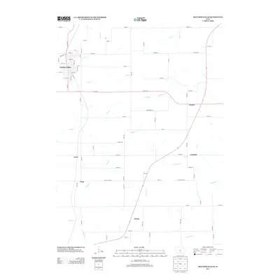
2013 Map of Melcher-Dallas
USGS Topo · Published 2013About this map
Melcher-Dallas serves as the primary population center in this Marion County landscape, where the town's street grid is defined by routes such as D Main St and Border St. The surrounding countryside is dotted with small historic settlements that hint at the area's agricultural and social evolution, including Gosport, Columbia, and Belinda. These communities are linked by a network of rural roads such as Co Hwy-G76 and Lucas Co Line Rd, which traverse a terrain shaped by numerous winding waterways. The drainage pattern is particularly intricate, dominated by English Cr and its tributaries like Long Br and Columbia Cr. This 2013 survey provides a clear view of the modern rural infrastructure, showing how newer residential placements and established farmsteads integrate with the natural courses of Crow Cr and Wildcat Cr.
Find a feature on this map
63 named features on this map. Tap any name to fly to it.
Don’t see what you’re looking for? This feature index may not catch every label — zoom into the map to look around manually.
Map Details
Editions of this 2013 Melcher-Dallas Map
This is the sole edition of this map. No revisions or reprints were ever made.
Other maps of this area

1909 · Knoxville
USGS Topo · 1:62,500

1910 · Milo
USGS Topo · 1:62,500

1912 · Knoxville
USGS Topo · 1:62,500

1918 · Chariton
USGS Topo · 1:62,500

1924 · Melcher
USGS Topo · 1:62,500

1954 · Des Moines
USGS Topo · 1:250,000

1956 · Des Moines
USGS Topo · 1:250,000

1957 · Des Moines
USGS Topo · 1:250,000
1965 · Knoxville SW
USGS Topo · 1:24,000
1965 · Beech
USGS Topo · 1:24,000