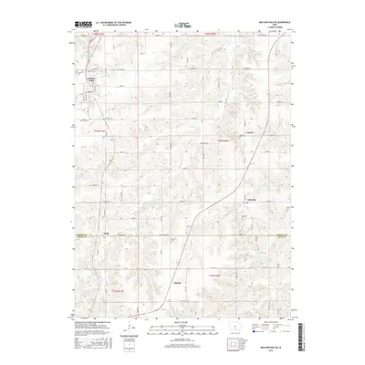
2015 Map of Melcher-Dallas
USGS Topo · Published 2015About this map
Melcher-Dallas serves as the primary hub in this portion of Marion County, where a grid of rural roads connects several small, distinct communities including Columbia, Gosport, and Belinda. The landscape is defined by the drainage patterns of English Creek and Columbia Creek, which cut through the agricultural terrain. For those researching local family history, the map provides precise locations for numerous burial sites scattered across the townships, such as Sacred Heart Cemetery near the main settlement, Strong Cemetery, and Stotts Cemetery on the eastern edge. The southern border marks the transition from Marion County into Lucas County along Lucas Co Line Road, near the community of Purdy. This modern survey preserves the spatial relationships between these long-standing rural Iowa settlements and their surrounding natural features like Long Branch and Crow Creek.
Find a feature on this map
56 named features on this map. Tap any name to fly to it.
Don’t see what you’re looking for? This feature index may not catch every label — zoom into the map to look around manually.
Map Details
Editions of this 2015 Melcher-Dallas Map
This is the sole edition of this map. No revisions or reprints were ever made.
Other maps of this area

1909 · Knoxville
USGS Topo · 1:62,500

1910 · Milo
USGS Topo · 1:62,500

1912 · Knoxville
USGS Topo · 1:62,500

1918 · Chariton
USGS Topo · 1:62,500

1924 · Melcher
USGS Topo · 1:62,500

1954 · Des Moines
USGS Topo · 1:250,000

1956 · Des Moines
USGS Topo · 1:250,000

1957 · Des Moines
USGS Topo · 1:250,000
1965 · Knoxville SW
USGS Topo · 1:24,000
1965 · Beech
USGS Topo · 1:24,000