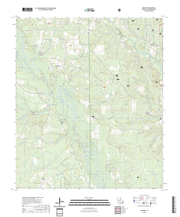
2024 Map of Melder
USGS Topo · Published 2024About this map
The Calcasieu River and its numerous tributaries, including Goodman Branch and Lemeuse Creek, define this portion of the Kisatchie National Forest in Rapides Parish. The settlement of Calcasieu sits at a crossroads in the western section, while the community of Melder occupies the northeastern corner. This modern topographic view reveals a landscape heavily shaped by forestry and rural aviation, notably evidenced by the Richmond Plantation Airport.
Find a feature on this map
74 named features on this map. Tap any name to fly to it.
Don’t see what you’re looking for? This feature index may not catch every label — zoom into the map to look around manually.
Map Details
Editions of this 2024 Melder Map
This is the sole edition of this map. No revisions or reprints were ever made.
Other maps of this area

1935 · Pawnee
USGS Topo · 1:31,680

1942 · Oakdale
USGS Topo · 1:62,500

1943 · Leander
USGS Topo · 1:62,500

1947 · Steep Gully
USGS Topo · 1:31,680

1949 · Glenmora
USGS Topo · 1:31,680

1951 · Steep Gully
USGS Topo · 1:24,000

1952 · Lake Charles
USGS Topo · 1:250,000

1953 · Alexandria
USGS Topo · 1:250,000
1954 · Pawnee
USGS Topo · 1:31,680
1954 · Leander
USGS Topo · 1:62,500