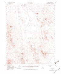
1952 Map of Mellan
USGS Topo · Published 1983About this map
Nellis Air Force Range occupies the core of this mid-century desert landscape, where military infrastructure and mining remnants meet. High-altitude targets, a Landing Field, and several observation towers are positioned across the broad expanse of Cactus Flat, reflecting the area's strategic use by the Department of the Army. Fading industrial roots are visible at Wilsons Camp and Trappman, situated near a designated Mining Area in the Trappman Hills. Water sources are critical but scarce in this arid environment, evidenced by isolated features like Antelope Springs, Sulphide Well, and a Water Tank. The topography is defined by prominent peaks and knobs, including Mount Helen and Gold Mountain, while the vast Dry Lake bed serves as a natural landmark between the Cactus Range and the Lizard Hills.
Find a feature on this map
25 named features on this map. Tap any name to fly to it.
Don’t see what you’re looking for? This feature index may not catch every label — zoom into the map to look around manually.
Map Details
Editions of this 1952 Mellan Map
3 editions found
Other maps of this area

1908 · Kawich
USGS Topo · 1:250,000

1942 · Tolicha Peak
USGS Topo · 1:125,000

1942 · Cactus Range
USGS Topo · 1:125,000

1942 · Reveille Peak
USGS Topo · 1:125,000

1942 · Wheelbarrow Peak
USGS Topo · 1:125,000

1952 · Stinking Spring
USGS Topo · 1:62,500

1952 · Mellan
USGS Topo · 1:62,500

1952 · Kawich Peak
USGS Topo · 1:62,500

1952 · Cactus Spring
USGS Topo · 1:62,500

1952 · Quartzite Mtn
USGS Topo · 1:62,500