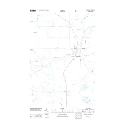
2013 Map of Mellen
USGS Topo · Published 2013About this map
The Bad River flows through the heart of Mellen, a community defined by its proximity to the rugged waterways and northern forests of Ashland County. Historically anchored by local industry, the area includes distinct neighborhoods and nearby settlements such as White City and Tannery Town, the latter reflecting the region's heritage of processing forest products. To the north, the confluence of the Bad River and Tyler Forks occurs within the boundaries of Copper Falls State Park, a site of significant natural drainage and geological features like Copper Falls.
Find a feature on this map
66 named features on this map. Tap any name to fly to it.
Don’t see what you’re looking for? This feature index may not catch every label — zoom into the map to look around manually.
Map Details
Editions of this 2013 Mellen Map
This is the sole edition of this map. No revisions or reprints were ever made.
Other maps of this area

1942 · Glidden
USGS Topo · 1:48,000

1942 · Clam Lake
USGS Topo · 1:48,000

1942 · Mellen
USGS Topo · 1:48,000

1942 · Marengo
USGS Topo · 1:48,000

1945 · Marengo
USGS Topo · 1:48,000

1945 · Clam Lake
USGS Topo · 1:48,000

1945 · Glidden
USGS Topo · 1:48,000

1945 · Mellen
USGS Topo · 1:48,000

1953 · Ashland
USGS Topo · 1:250,000
1956 · Mt. Whittlesey
USGS Topo · 1:24,000