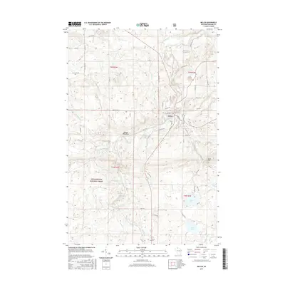
2015 Map of Mellen
USGS Topo · Published 2015About this map
The Bad River and its numerous tributaries, including Tyler Forks and Devils Creek, carve through this northern Wisconsin landscape as it appeared in the early 21st century. The city of Mellen serves as the primary hub, where local routes like South Main Street and Lake Drive connect the community to the surrounding timber and recreational lands. To the south, the settlement of Cayuga sits near a local Cemetery, while Foster Junction marks a point of historical transit interest. Much of the western half of the map is dominated by the Chequamegon National Forest, where drainages such as Gravelly Brook and Hardscrabble flow through the wooded terrain. High points like Eagles Peak overlook a series of glacial water bodies, including Meder Lake, Long Lake, and Murphy Lake, illustrating the complex hydrology of the Lake Superior highland region.
Find a feature on this map
73 named features on this map. Tap any name to fly to it.
Don’t see what you’re looking for? This feature index may not catch every label — zoom into the map to look around manually.
Map Details
Editions of this 2015 Mellen Map
This is the sole edition of this map. No revisions or reprints were ever made.
Other maps of this area

1942 · Glidden
USGS Topo · 1:48,000

1942 · Clam Lake
USGS Topo · 1:48,000

1942 · Mellen
USGS Topo · 1:48,000

1942 · Marengo
USGS Topo · 1:48,000

1945 · Marengo
USGS Topo · 1:48,000

1945 · Clam Lake
USGS Topo · 1:48,000

1945 · Glidden
USGS Topo · 1:48,000

1945 · Mellen
USGS Topo · 1:48,000

1953 · Ashland
USGS Topo · 1:250,000
1956 · Mt. Whittlesey
USGS Topo · 1:24,000