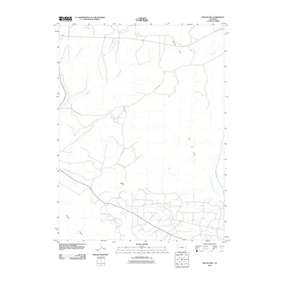
2010 Map of Mellen Hill
USGS Topo · Published 2010About this map
Mellen Hill rises as the central landmark in this high-desert landscape of Northwest Colorado, where complex drainage systems and isolated cattle-range infrastructure define the terrain. The northern half of the quadrangle is dominated by the convergence of West Twin Wash and East Twin Wash, which weave through a network of dry draws and seasonal drainages. Water management is evidenced by the Dripping Rock Reservoir situated along Dripping Rock Rd, serving as a critical point for local ranching or resource operations. In the southeastern portion, the named Coal Oil Gulch hints at the region's mineral history, while the elevated Raven Ridge provides a distinct topographic boundary to the southwest. This 2010 survey by the U.S. Geological Survey illustrates a sparsely populated but active corridor marked by county routes like County Rd 98 and County Hwy 1.
Find a feature on this map
15 named features on this map. Tap any name to fly to it.
Don’t see what you’re looking for? This feature index may not catch every label — zoom into the map to look around manually.
Map Details
Editions of this 2010 Mellen Hill Map
This is the sole edition of this map. No revisions or reprints were ever made.
Other maps of this area

1885 · Ashley
USGS Topo · 1:250,000

1907 · Rangely
USGS Topo · 1:125,000

1907 · Jensen
USGS Topo · 1:125,000

1910 · Jensen
USGS Topo · 1:125,000

1910 · Rangely
USGS Topo · 1:125,000

1954 · Vernal
USGS Topo · 1:250,000

1958 · Vernal
USGS Topo · 1:250,000

1960 · Vernal
USGS Topo · 1:250,000

1962 · Lazy Y Point
USGS Topo · 1:24,000

1962 · Rangely NE
USGS Topo · 1:24,000