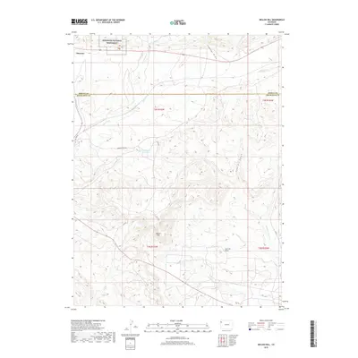
2019 Map of Mellen Hill
USGS Topo · Published 2019About this map
Dinosaur National Monument occupies the northwestern corner of this 2019 survey, where the small community of Dinosaur serves as a gateway to the high desert landscapes of northwest Colorado. The terrain is defined by a series of dramatic drainages and basins, notably Coal Oil Basin and the winding course of Twin Wash. Water management in this arid environment is evidenced by the Dripping Rock Reservoir, situated along Dripping Rock Rd near the confluence of local gulches. The map also documents the boundary between Moffat and Rio Blanco counties, which bisects the quadrangle horizontally. Cattle ranching and resource management are suggested by the network of rural routes such as Co Rd 98 and Co Rd 1, which navigate the elevation changes around Mellen Hill.
Find a feature on this map
22 named features on this map. Tap any name to fly to it.
Don’t see what you’re looking for? This feature index may not catch every label — zoom into the map to look around manually.
Map Details
Editions of this 2019 Mellen Hill Map
This is the sole edition of this map. No revisions or reprints were ever made.
Other maps of this area

1885 · Ashley
USGS Topo · 1:250,000

1907 · Rangely
USGS Topo · 1:125,000

1907 · Jensen
USGS Topo · 1:125,000

1910 · Jensen
USGS Topo · 1:125,000

1910 · Rangely
USGS Topo · 1:125,000

1954 · Vernal
USGS Topo · 1:250,000

1958 · Vernal
USGS Topo · 1:250,000

1960 · Vernal
USGS Topo · 1:250,000

1962 · Lazy Y Point
USGS Topo · 1:24,000

1962 · Rangely NE
USGS Topo · 1:24,000