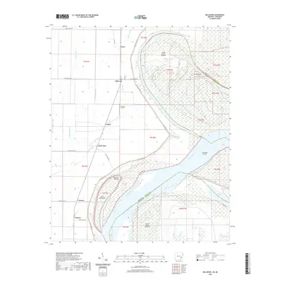
2020 Map of Mellwood
USGS Topo · Published 2020About this map
The Mississippi River defines the landscape here, snaking between Arkansas and Mississippi across a series of major river features. This 2020 edition provides a clear view of the shifting alluvial geography where Island Number Sixtyfive and Jackson Point dominate the northern river bend. The map illustrates a distinct pattern of agricultural land use and drainage, where networks of bayous like Big Sandy Bayou and Bee Bayou interlace with local rural routes.
Find a feature on this map
38 named features on this map. Tap any name to fly to it.
Don’t see what you’re looking for? This feature index may not catch every label — zoom into the map to look around manually.
Map Details
Editions of this 2020 Mellwood Map
This is the sole edition of this map. No revisions or reprints were ever made.
Other maps of this area

1930 · Mellwood
USGS Topo · 1:62,500

1939 · Modoc
USGS Topo · 1:62,500

1939 · Indian Bay
USGS Topo · 1:62,500

1939 · Henrico
USGS Topo · 1:62,500

1939 · Mellwood
USGS Topo · 1:62,500

1948 · Helena
USGS Topo · 1:250,000

1948 · Modoc
USGS Topo · 1:62,500

1950 · Helena
USGS Topo · 1:250,000

1954 · Mellwood
USGS Topo · 1:62,500

1954 · Indian Bay
USGS Topo · 1:62,500