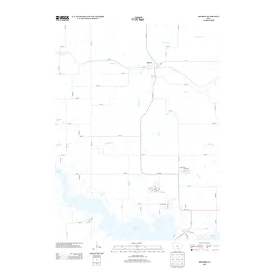
2013 Map of Melrose
USGS Topo · Published 2013About this map
Melrose serves as the central hub of this Monroe County landscape, situated where Main St and Erin Ave intersect near the meandering path of Cedar Cr. The southern portion of the region is defined by the significant reach of Rathbun Lake, which creates a complex shoreline characterized by numerous inlets and coves. This modern 2013 survey illustrates a rural Iowa environment where a grid-like network of roads, including Co Hwy S70 and Co Hwy H44, navigates around a dense system of waterways. Numerous small tributaries such as Contrary Cr, Bee Br, and Bleubaugh Cr drain the surrounding hills into the larger basin. The map captures the specialized interface between the developed town site and the managed water resources of the reservoir, highlighting the transition from residential streets to the expansive aquatic recreation area.
Find a feature on this map
70 named features on this map. Tap any name to fly to it.
Don’t see what you’re looking for? This feature index may not catch every label — zoom into the map to look around manually.
Map Details
Editions of this 2013 Melrose Map
This is the sole edition of this map. No revisions or reprints were ever made.
Other maps of this area

1924 · Melcher
USGS Topo · 1:62,500

1929 · Albia
USGS Topo · 1:62,500

1935 · Russell
USGS Topo · 1:62,500

1938 · Russell
USGS Topo · 1:62,500

1939 · Mystic
USGS Topo · 1:62,500

1942 · Mystic
USGS Topo · 1:62,500

1954 · Centerville
USGS Topo · 1:250,000

1954 · Des Moines
USGS Topo · 1:250,000

1956 · Des Moines
USGS Topo · 1:250,000

1957 · Des Moines
USGS Topo · 1:250,000