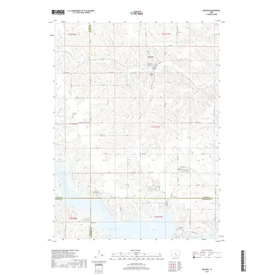
2018 Map of Melrose
USGS Topo · Published 2018About this map
Melrose sits at the northern end of this landscape, a town defined by its proximity to several early burial grounds including Melrose Methodist Cem and Mount Calvary Cem. The terrain is characterized by the complex drainage network of Cedar Cr and Bleubaugh Cr, which flow toward the significant waters of Rathbun Lake in the southern and western reaches. This area is a point of intersection for four counties — Monroe, Lucas, Wayne, and Appanoose — creating a unique geographic junction. Historical movement through the region is visible in the alignment of the Morman Trails Trace Rd and Morman Trl, which cut across the rolling hills of Southern Iowa. Rural life is further mapped through scattered sites like Greenville Cem and Evans Cem, marking the locations of long-standing community centers in this river-and-creek-carved landscape.
Find a feature on this map
57 named features on this map. Tap any name to fly to it.
Don’t see what you’re looking for? This feature index may not catch every label — zoom into the map to look around manually.
Map Details
Editions of this 2018 Melrose Map
This is the sole edition of this map. No revisions or reprints were ever made.
Other maps of this area

1924 · Melcher
USGS Topo · 1:62,500

1929 · Albia
USGS Topo · 1:62,500

1935 · Russell
USGS Topo · 1:62,500

1938 · Russell
USGS Topo · 1:62,500

1939 · Mystic
USGS Topo · 1:62,500

1942 · Mystic
USGS Topo · 1:62,500

1954 · Centerville
USGS Topo · 1:250,000

1954 · Des Moines
USGS Topo · 1:250,000

1956 · Des Moines
USGS Topo · 1:250,000

1957 · Des Moines
USGS Topo · 1:250,000