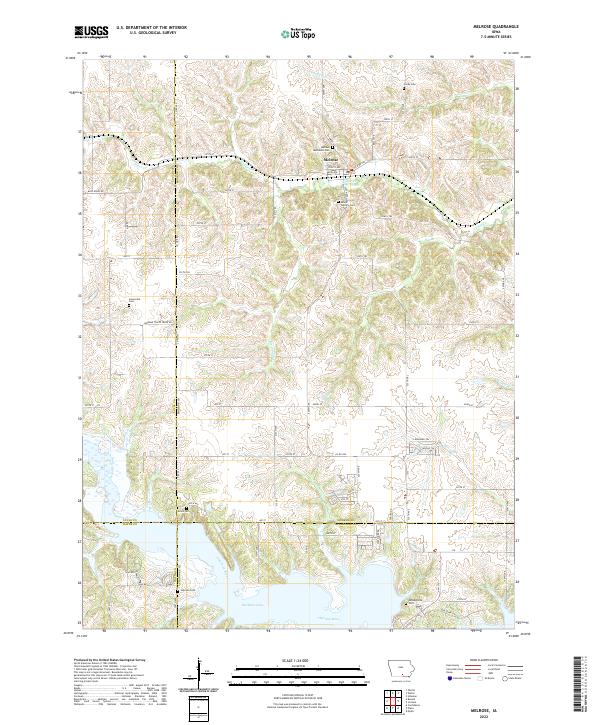
2022 Map of Melrose
USGS Topo · Published 2022About this map
The settlement of Melrose serves as the focal point of this rural southern Iowa landscape, situated near the northern edge of the massive Rathbun Lake impoundment. The terrain is defined by the winding course of the Chariton River and its numerous tributaries, including Cedar Cr and Contrary Cr, which carve through the undulating topography. This area is remarkably dense with historical burial sites, preserving the names of early communities and families through locations such as Hardy Cem, Mount Calvary Cem, and Greenville Cem. The presence of Morman Trails Trace Rd running through the central portion of the map indicates the lasting imprint of pioneer migration routes on the modern road network. The map further highlights the convergence of four counties—Monroe, Lucas, Wayne, and Appanoose—marking it as a significant jurisdictional crossroads in the region.
Find a feature on this map
66 named features on this map. Tap any name to fly to it.
Don’t see what you’re looking for? This feature index may not catch every label — zoom into the map to look around manually.
Map Details
Editions of this 2022 Melrose Map
This is the sole edition of this map. No revisions or reprints were ever made.
Other maps of this area

1924 · Melcher
USGS Topo · 1:62,500

1929 · Albia
USGS Topo · 1:62,500

1935 · Russell
USGS Topo · 1:62,500

1938 · Russell
USGS Topo · 1:62,500

1939 · Mystic
USGS Topo · 1:62,500

1942 · Mystic
USGS Topo · 1:62,500

1954 · Centerville
USGS Topo · 1:250,000

1954 · Des Moines
USGS Topo · 1:250,000

1956 · Des Moines
USGS Topo · 1:250,000

1957 · Des Moines
USGS Topo · 1:250,000