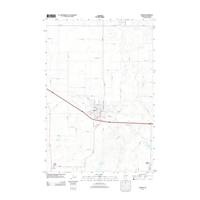
2013 Map of Melrose
USGS Topo · Published 2013About this map
The Sauk River meanders through this portion of Stearns County, serving as the central geographic feature for the city of Melrose. The landscape is a complex network of glacial hydrology and agricultural drainage, evidenced by the presence of County Ditch Number Forty-two and numerous named water bodies including Black Oak Lake, Frevels Lake, and Sylvia Lake. The river itself widens into Melrose Lake at the heart of the primary settlement, where the street grid is tightly organized around W Main St and W Riverside Ave.
Find a feature on this map
53 named features on this map. Tap any name to fly to it.
Don’t see what you’re looking for? This feature index may not catch every label — zoom into the map to look around manually.
Map Details
Editions of this 2013 Melrose Map
This is the sole edition of this map. No revisions or reprints were ever made.
Other maps of this area

1950 · Swanville
USGS Topo · 1:62,500

1953 · Saint Cloud
USGS Topo · 1:250,000

1957 · Saint Cloud
USGS Topo · 1:250,000

1958 · Saint Cloud
USGS Topo · 1:250,000

1965 · Greenwald
USGS Topo · 1:24,000

1965 · Sauk Centre
USGS Topo · 1:24,000

1965 · Melrose
USGS Topo · 1:24,000

1965 · Freeport
USGS Topo · 1:24,000

1965 · Elrosa
USGS Topo · 1:24,000

1965 · St Martin
USGS Topo · 1:24,000
Featured Places
- Melrose, MN
- New Munich, MN
- Meire Grove, MN
- Melrose Mobile Home Park, Melrose
- Rose Terrace Mobile Home Park, Melrose