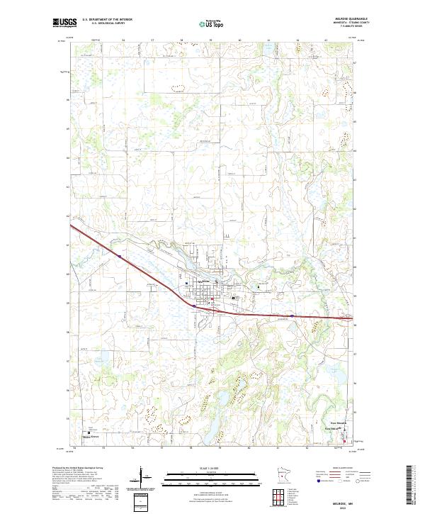
2022 Map of Melrose
USGS Topo · Published 2022About this map
Melrose serves as the central hub of this Stearns County landscape, where the Sauk River winds through a terrain defined by agricultural grid lines and glacial water bodies. The settlement pattern is anchored by small communities such as Meire Grove to the southwest and New Munich in the southeast, each established around the spiritual and social foundations of local parishes. This is evidenced by the numerous consecrated grounds throughout the area, including Saint Johns Cem, Saint Marys Cem, and Saint Patrick Cem.
Find a feature on this map
56 named features on this map. Tap any name to fly to it.
Don’t see what you’re looking for? This feature index may not catch every label — zoom into the map to look around manually.
Map Details
Editions of this 2022 Melrose Map
This is the sole edition of this map. No revisions or reprints were ever made.
Other maps of this area

1950 · Swanville
USGS Topo · 1:62,500

1953 · Saint Cloud
USGS Topo · 1:250,000

1957 · Saint Cloud
USGS Topo · 1:250,000

1958 · Saint Cloud
USGS Topo · 1:250,000

1965 · Greenwald
USGS Topo · 1:24,000

1965 · Sauk Centre
USGS Topo · 1:24,000

1965 · Melrose
USGS Topo · 1:24,000

1965 · Freeport
USGS Topo · 1:24,000

1965 · Elrosa
USGS Topo · 1:24,000

1965 · St Martin
USGS Topo · 1:24,000
Featured Places
- Melrose, MN
- New Munich, MN
- Meire Grove, MN
- Melrose Mobile Home Park, Melrose
- Rose Terrace Mobile Home Park, Melrose