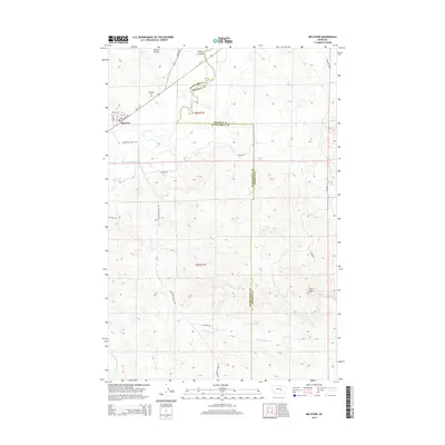
2014 Map of Melstone
USGS Topo · Published 2014About this map
Melstone serves as the primary hub in this prairie landscape, situated near the winding course of the Musselshell River. The town's grid is anchored by Railway Ave and thoroughfares like 6th Ave, reflecting its orientation toward the regional transportation network. Beyond the town limits, the terrain is defined by a series of drainage coulees and creeks, including Wilson Coulee to the north and the multi-branched Lost Horse Cr system to the south. The Musselshell and Rosebud County line bisects the territory vertically, marking a jurisdictional divide across the high ground near Twin Tops. Local history is anchored at the Melstone Cem on the northwestern outskirts, while a web of secondary routes like Melstone-Custer Rd and Bascomb Rd provide access to the surrounding ranching and agricultural lands.
Find a feature on this map
24 named features on this map. Tap any name to fly to it.
Don’t see what you’re looking for? This feature index may not catch every label — zoom into the map to look around manually.
Map Details
Editions of this 2014 Melstone Map
This is the sole edition of this map. No revisions or reprints were ever made.
Other maps of this area

1954 · Forsyth
USGS Topo · 1:250,000

1957 · Forsyth
USGS Topo · 1:250,000

1958 · Forsyth
USGS Topo · 1:250,000

1962 · Queens Point
USGS Topo · 1:24,000

1962 · Guthridge Ranch
USGS Topo · 1:24,000

1962 · Melstone NE
USGS Topo · 1:24,000

1962 · Melstone NW
USGS Topo · 1:24,000

1962 · Grebe Ranch
USGS Topo · 1:24,000

1963 · Melstone
USGS Topo · 1:24,000

1979 · Melstone
USGS Topo · 1:100,000