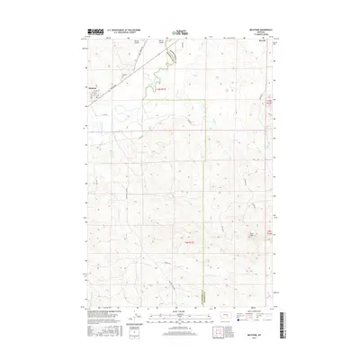
2017 Map of Melstone
USGS Topo · Published 2017About this map
The Musselshell River meanders through this portion of central Montana, defining the landscape around the town of Melstone. The settlement's street grid, including Railway Ave and several numbered avenues, reflects its history as a rail-oriented community. Outside the town limits, the terrain is shaped by numerous intermittent drainages such as Lost Horse Cr and East Horse Cr, alongside geographic landmarks like Wilson Coulee and the Twin Tops elevations. For those researching local heritage, the map identifies the Melstone Cem and the former railroad siding area of Bascom to the northeast. The boundary between Musselshell Co and Rosebud Co cuts through the eastern half of the sheet, while a network of rural roads like Adams Rd and Melstone-Custer Rd connects isolated ranching properties across the undulating plains.
Find a feature on this map
31 named features on this map. Tap any name to fly to it.
Don’t see what you’re looking for? This feature index may not catch every label — zoom into the map to look around manually.
Map Details
Editions of this 2017 Melstone Map
This is the sole edition of this map. No revisions or reprints were ever made.
Other maps of this area

1954 · Forsyth
USGS Topo · 1:250,000

1957 · Forsyth
USGS Topo · 1:250,000

1958 · Forsyth
USGS Topo · 1:250,000

1962 · Queens Point
USGS Topo · 1:24,000

1962 · Guthridge Ranch
USGS Topo · 1:24,000

1962 · Melstone NE
USGS Topo · 1:24,000

1962 · Melstone NW
USGS Topo · 1:24,000

1962 · Grebe Ranch
USGS Topo · 1:24,000

1963 · Melstone
USGS Topo · 1:24,000

1979 · Melstone
USGS Topo · 1:100,000