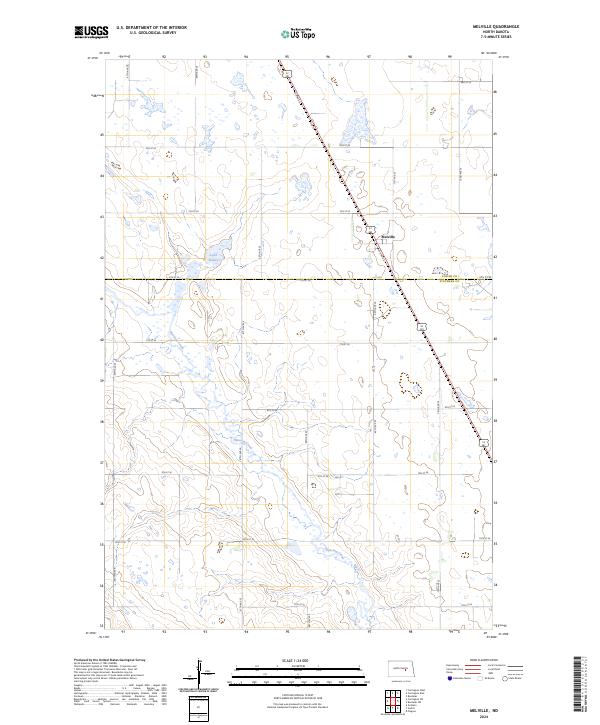
2024 Map of Melville
USGS Topo · Published 2024About this map
Pipestem Creek meanders through the heart of this North Dakota landscape, carving a low-lying drainage across the prairie. This 2024 survey documents the agricultural grid of central North Dakota, highlighting the rural settlement of Melville situated along the path of U.S. Route 52 and 281. The terrain is characterized by numerous small potholes and wetlands typical of the region, with Lake Bonita serving as a notable water body in the northern sections. The map clearly defines the boundary between Foster Co and Stutsman Co, providing a precise look at the township and range lines that have governed land division here since the late 19th century. Local transportation is defined by a dense network of section-line roads, such as 68th Ave SE and 6th St SE, which provide access to the vast farmsteads and field systems that dominate the local economy.
Find a feature on this map
25 named features on this map. Tap any name to fly to it.
Don’t see what you’re looking for? This feature index may not catch every label — zoom into the map to look around manually.
Map Details
Editions of this 2024 Melville Map
This is the sole edition of this map. No revisions or reprints were ever made.
Other maps of this area

1900 · Pingree
USGS Topo · 1:125,000

1900 · Pingree
USGS Topo · 1:62,500

1948 · Carrington
USGS Topo · 1:62,500

1950 · Carrington East
USGS Topo · 1:24,000

1950 · Melville
USGS Topo · 1:24,000

1950 · Carrington SW
USGS Topo · 1:24,000

1950 · Carrington West
USGS Topo · 1:24,000

1951 · Pingree
USGS Topo · 1:24,000

1951 · Bordulac SW
USGS Topo · 1:24,000
1951 · Bordulac
USGS Topo · 1:24,000