2023 Map of Memphis
USGS Topo · Published 2023About this map
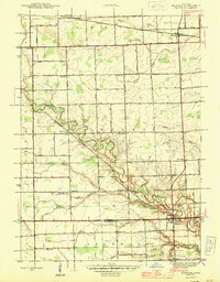
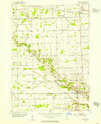
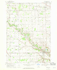
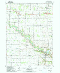
Memphis and the surrounding farmland of St. Clair and Macomb Counties are defined by an intricate network of waterways and rural section lines. The settlement at Memphis sits at the southern edge of the map, where Beaver Creek and Ashery Creek join the Belle River. This landscape is primarily agricultural, evidenced by the extensive system of agricultural drainage features like the Riley-Wales Drain, Cowhy Drain, and Emmett Drain. Further north, the village of Emmett and the settlement of Riley Center anchor the local community.
Find a feature on this map
63 named features on this map. Tap any name to fly to it.
Don’t see what you’re looking for? This feature index may not catch every label — zoom into the map to look around manually.
Map Details
Editions of this 2023 Memphis Map
This is the sole edition of this map. No revisions or reprints were ever made.
Historical Maps of Memphis Through Time
5 maps found