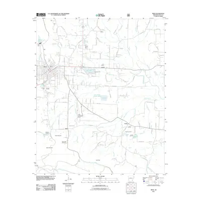
2011 Map of Mena
USGS Topo · Published 2011About this map
The Kansas City Southern railroad serves as the industrial spine for this region of Polk County, running directly through the heart of Mena. This 2011 survey documents a landscape where aviation and water management are central to the local infrastructure, featuring the Mena Intermountain Municipal Airport and a series of reservoirs including Mena Lake, Ward Lake, and Cox Lake. The settlement pattern reflects the area's rural heritage, with smaller communities like Nunley, Corinth, and Dallas situated along the creeks and valleys that define the terrain.
Find a feature on this map
130 named features on this map. Tap any name to fly to it.
Don’t see what you’re looking for? This feature index may not catch every label — zoom into the map to look around manually.
Map Details
Editions of this 2011 Mena Map
This is the sole edition of this map. No revisions or reprints were ever made.
Other maps of this area

1890 · Poteau Mountain
USGS Topo · 1:125,000

1899 · Poteau Mountain
USGS Topo · 1:125,000

1913 · De Queen
USGS Topo · 1:125,000

1950 · Mcalester
USGS Topo · 1:250,000
1958 · Board Camp
USGS Topo · 1:24,000

1958 · Mena
USGS Topo · 1:62,500

1958 · Potter
USGS Topo · 1:62,500

1958 · Mena
USGS Topo · 1:24,000
1958 · Y City
USGS Topo · 1:24,000

1958 · Rich Mountain
USGS Topo · 1:24,000