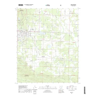
2020 Map of Mena
USGS Topo · Published 2020About this map
Mena serves as the focal point of this Arkansas survey, situated where the Arkansas and Choctaw Railroad once spurred development at the foot of the Ouachita Mountains. The town's civic heart is anchored by the Polk County Courthouse, while educational and transportation hubs like the University of Arkansas Rich Mountain and Mena Intermountain Municipal Airport define its modern footprint. Beyond the city limits, the terrain transitions into the protected lands of the Ouachita National Forest, marked by significant elevations such as Rich Mountain and Earthquake Ridge.
Find a feature on this map
177 named features on this map. Tap any name to fly to it.
Don’t see what you’re looking for? This feature index may not catch every label — zoom into the map to look around manually.
Map Details
Editions of this 2020 Mena Map
This is the sole edition of this map. No revisions or reprints were ever made.
Other maps of this area

1890 · Poteau Mountain
USGS Topo · 1:125,000

1899 · Poteau Mountain
USGS Topo · 1:125,000

1913 · De Queen
USGS Topo · 1:125,000

1950 · Mcalester
USGS Topo · 1:250,000
1958 · Board Camp
USGS Topo · 1:24,000

1958 · Mena
USGS Topo · 1:62,500

1958 · Potter
USGS Topo · 1:62,500

1958 · Mena
USGS Topo · 1:24,000
1958 · Y City
USGS Topo · 1:24,000

1958 · Rich Mountain
USGS Topo · 1:24,000