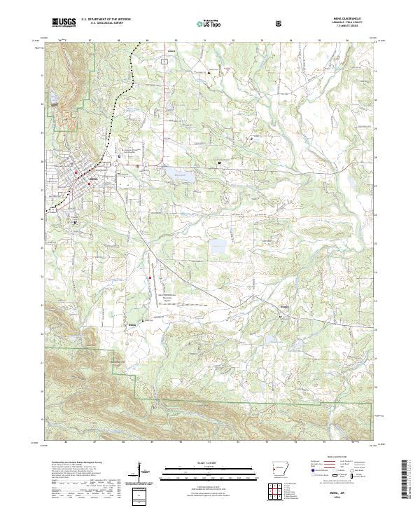
2024 Map of Mena
USGS Topo · Published 2024About this map
Mena serves as the regional hub for Polk County, with the Polk County Courthouse and the University of Arkansas Rich Mountain campus established as central fixtures in the town’s layout. The Kansas City Southern railroad remains a defining industrial corridor, cutting through the heart of the community as it parallels the Ouachita River to the north. Smaller surrounding settlements like Acorn, Dallas, and Nunley are clearly marked, providing essential context for researchers tracing local family lineages through sites such as Dallas Cem and Nunley Cem.
Find a feature on this map
163 named features on this map. Tap any name to fly to it.
Don’t see what you’re looking for? This feature index may not catch every label — zoom into the map to look around manually.
Map Details
Editions of this 2024 Mena Map
This is the sole edition of this map. No revisions or reprints were ever made.
Other maps of this area

1890 · Poteau Mountain
USGS Topo · 1:125,000

1899 · Poteau Mountain
USGS Topo · 1:125,000

1913 · De Queen
USGS Topo · 1:125,000

1950 · Mcalester
USGS Topo · 1:250,000
1958 · Board Camp
USGS Topo · 1:24,000

1958 · Mena
USGS Topo · 1:62,500

1958 · Potter
USGS Topo · 1:62,500

1958 · Mena
USGS Topo · 1:24,000
1958 · Y City
USGS Topo · 1:24,000

1958 · Rich Mountain
USGS Topo · 1:24,000