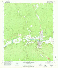
1970 Map of Menard
USGS Topo · Published 1973About this map
The San Saba River defines the landscape of Menard, Texas, in the early 1970s, where the river's path is closely followed by the Menard Irrigation Company Canal. This vital water infrastructure supported the local agricultural economy, while the Atchison Topeka and Santa Fe railroad provided the necessary transport links to the outside world. To the west of the town center, the San Saba Mission (Ruins) marks a significant historical site adjacent to the local Golf Course.
Find a feature on this map
26 named features on this map. Tap any name to fly to it.
Don’t see what you’re looking for? This feature index may not catch every label — zoom into the map to look around manually.
Map Details
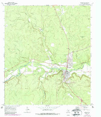
Editions of this 1970 Menard Map
2 editions found
Other maps of this area

1892 · Eden
USGS Topo · 1:125,000

1896 · Eden
USGS Topo · 1:125,000

1954 · Brownwood
USGS Topo · 1:250,000

1954 · Llano
USGS Topo · 1:250,000

1955 · Llano
USGS Topo · 1:250,000

1956 · Llano
USGS Topo · 1:250,000

1970 · Callan
USGS Topo · 1:24,000

1970 · Clear Creek Lake
USGS Topo · 1:24,000

1970 · San Augustine Draw
USGS Topo · 1:24,000

1970 · East Elm Creek
USGS Topo · 1:24,000