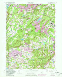
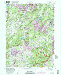
1954 Map of Mendham
USGS Topo · Published 1982About this map
Greystone Park State Hospital anchors the northeast portion of this Morris County terrain, highlighting a significant era of institutional land use alongside the County Welfare House and Sanatorium. The landscape transitions from the urban edges of Dover Town and Kenvil in the north toward the preserved grounds of the Morristown National Historical Park in the south, where the Wick House stands as a landmark of the Revolutionary War encampment.
Find a feature on this map
80 named features on this map. Tap any name to fly to it.
Don’t see what you’re looking for? This feature index may not catch every label — zoom into the map to look around manually.
Map Details
Editions of this 1954 Mendham Map
5 editions found
Other maps of this area

1888 · Plainfield
USGS Topo · 1:62,500

1888 · Morristown
USGS Topo · 1:62,500

1888 · Lake Hopatcong
USGS Topo · 1:62,500

1891 · Somerville
USGS Topo · 1:62,500

1893 · Plainfield
USGS Topo · 1:62,500

1893 · Somerville
USGS Topo · 1:62,500

1894 · Morristown
USGS Topo · 1:62,500

1894 · Lake Hopatcong
USGS Topo · 1:62,500

1898 · Lake Hopatcong
USGS Topo · 1:62,500

1898 · Morristown
USGS Topo · 1:62,500