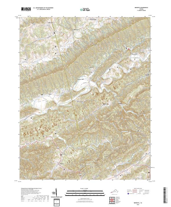
2022 Map of Mendota
USGS Topo · Published 2022About this map
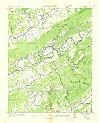
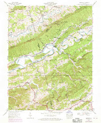
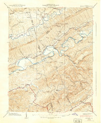
Clinch Mountain dominates the central landscape of this territory, where the borders of Washington, Scott, and Russell Counties converge. This complex terrain of high ridges and deep hollows, such as Gouldman Hollow and Baker Hollow, has historically dictated the settlement patterns of rural communities like Mendota and Shelleys. The North Fork Holston River winds through the center of the quadrangle, serving as a primary corridor for early transit and industry, exemplified by Barker Mill. Numerous family and church cemeteries, including the Free Hill Church Cem and Fleenor Cem, are scattered across the slopes of Moccasin Ridge and Poor Valley, providing vital landmarks for genealogical research. The road network, featuring AP Carter Hwy and various rural routes like Federal Rd, reflects the area's continued reliance on the valleys for connectivity between isolated mountain hamlets.
Find a feature on this map
109 named features on this map. Tap any name to fly to it.
Don’t see what you’re looking for? This feature index may not catch every label — zoom into the map to look around manually.
Map Details
Editions of this 2022 Mendota Map
This is the sole edition of this map. No revisions or reprints were ever made.
Historical Maps of Phillip Through Time
4 maps found