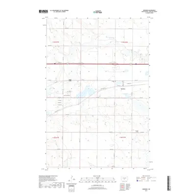
2017 Map of Menoken
USGS Topo · Published 2017About this map
The community of Menoken serves as a central point on this modern landscape, situated where the BNSF Railway parallels the historic path of Co Hwy 10. The terrain is defined by the winding course of Apple Creek, which cuts through the northern and western sections of the quadrangle. Residential developments such as Apple Valley show the expanding footprint of the area, while established landmarks like the Menoken Cem and Bearpaw Airport provide specific points of interest for local historians. In the southern portion of the map, Solberg Butte rises as a distinct topographical feature. The grid of section lines and township boundaries, including t139n r78w and t138n r79w, organizes the prairie landscape, punctuated by small wetlands and a network of rural roads such as Lincoln Rd and 22nd Ave SE.
Find a feature on this map
30 named features on this map. Tap any name to fly to it.
Don’t see what you’re looking for? This feature index may not catch every label — zoom into the map to look around manually.
Map Details
Editions of this 2017 Menoken Map
This is the sole edition of this map. No revisions or reprints were ever made.
Other maps of this area

1907 · Bismarck
USGS Topo · 1:125,000

1951 · Menoken SW
USGS Topo · 1:24,000

1951 · Menoken
USGS Topo · 1:62,500

1951 · McKenzie
USGS Topo · 1:62,500

1954 · Bismarck
USGS Topo · 1:250,000

1958 · Bismarck
USGS Topo · 1:250,000

1962 · Sugarloaf Butte
USGS Topo · 1:24,000

1962 · Menoken SW
USGS Topo · 1:24,000

1971 · Huff NE
USGS Topo · 1:24,000

1971 · Moffit NW
USGS Topo · 1:24,000