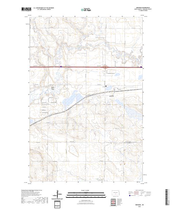
2024 Map of Menoken
USGS Topo · Published 2024About this map
Apple Creek meanders through this section of the northern Great Plains, defining a landscape shaped by both agriculture and conservation. The unincorporated community of Menoken serves as a focal point near the BNSF Railway, where the local Menoken Cem provides a genealogical touchstone for area families. This 2024 map documents a period of residential growth near the state capital, visible in the developing residential clusters of Apple Valley and the network of roads including Co Hwy 10 and Apple Creek Rd. Large-scale environmental preservation is represented by the Burleigh County Waterfowl Production Area, which spans significant acreage south of the interstate. Away from the primary settlements, the terrain is dotted with small-scale features like the Bearpaw Airport, reflecting the rural aviation and transport patterns of modern North Dakota.
Find a feature on this map
43 named features on this map. Tap any name to fly to it.
Don’t see what you’re looking for? This feature index may not catch every label — zoom into the map to look around manually.
Map Details
Editions of this 2024 Menoken Map
This is the sole edition of this map. No revisions or reprints were ever made.
Other maps of this area

1907 · Bismarck
USGS Topo · 1:125,000

1951 · Menoken SW
USGS Topo · 1:24,000

1951 · Menoken
USGS Topo · 1:62,500

1951 · McKenzie
USGS Topo · 1:62,500

1954 · Bismarck
USGS Topo · 1:250,000

1958 · Bismarck
USGS Topo · 1:250,000

1962 · Sugarloaf Butte
USGS Topo · 1:24,000

1962 · Menoken SW
USGS Topo · 1:24,000

1971 · Huff NE
USGS Topo · 1:24,000

1971 · Moffit NW
USGS Topo · 1:24,000