2022 Map of Menomonee Falls
USGS Topo · Published 2022About this map
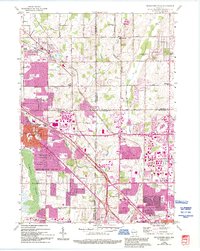
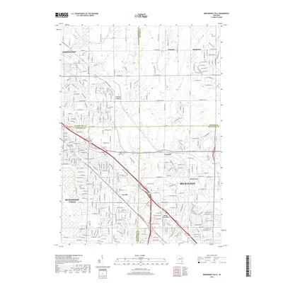
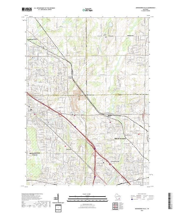
Menomonee Falls and the surrounding borderlands of Waukesha, Milwaukee, Washington, and Ozaukee counties are shown here in a period of established suburban density. The area is defined by the winding course of the Menomonee River and its tributaries, including Little Menomonee River and Pigeon Cr. While much of the landscape is developed, natural features like the Tamarac Swamp persist near the western edge. For family historians, the map is remarkably detailed regarding religious and burial sites, marking several distinct locations such as Saint Mary's Cem, Saint Anthony Cem, and the Trinity Lutheran Cem Old in Freistadt. The geography retains the footprints of older hamlets like Fussville, Victory Center, and West Granville, which have been integrated into the modern grid of the Milwaukee metropolitan periphery.
Find a feature on this map
171 named features on this map. Tap any name to fly to it.
Don’t see what you’re looking for? This feature index may not catch every label — zoom into the map to look around manually.
Map Details
Editions of this 2022 Menomonee Falls Map
This is the sole edition of this map. No revisions or reprints were ever made.
Historical Maps of Milwaukee Through Time
6 maps found